


03 May 2024
|
 The Old Coach Road takes you up onto Threlkeld Common
: credit: © Neil Watterson
The Old Coach Road takes you up onto Threlkeld Common
: credit: © Neil Watterson
Cumbria is a magnet for those who enjoy rugged scenery – and there are plenty of greenlanes too. We drive four of the best, including the epic Gatescarth Pass
Sometimes you can fall into using clichés when writing about greenlanes. Not every lane can be superb, offer challenging driving or have spectacular views – though it would be great if they could.
Instead, many are just simple roads that take you from A to B, roads that didn’t warrant the expenditure to gain a tarmac coating. Those are the greenlanes that most of us enjoy on our travels, but sometimes it’s worth making a trip for the superb, challenging and spectacular ones – and that’s what we’re doing in this issue of Land Rover Monthly. We’re crossing Cumbria on some of the best greenlanes in the county; arguably some of the best in the country.

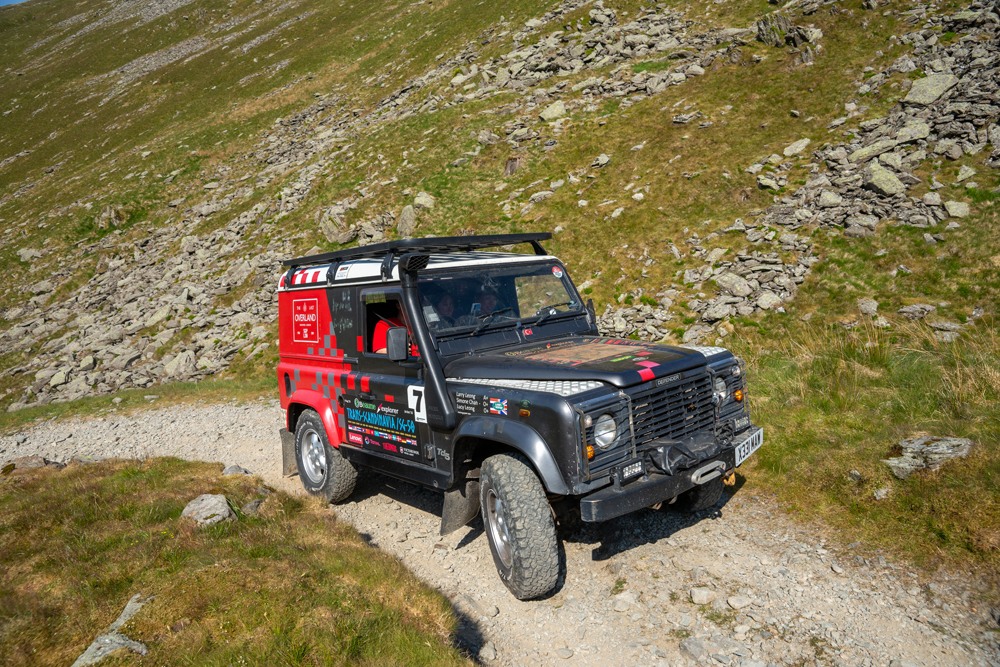
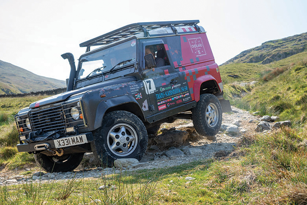
Lucy, Simone and Larry and their much-travelled 90. Inset: Russ Dykes and Richard Canterbury brought along their Discovery 2s
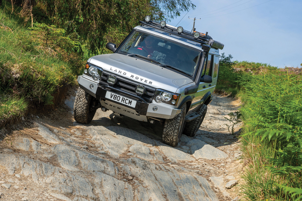
We’re in three Land Rovers: Russ Dykes is leading in his much-travelled Discovery 2; Richard Canterbury is in his own, fabulously rebuilt Discovery 2 and Larry Leong, Simone Chan and daughter Lucy Leong are aboard a Defender 90.
Russ has been in the magazine loads over the years, and we featured Richard’s Disco 2 in our July 2023 issue (read the feature here). Enthusiasts will know Larry from his role on the Last Overland trip, where he was part of the team retracing the route of the 1955 London-Singapore first overland trip, accompanying Oxford, one of the Series Is.
We’ve met up at the Rusland Pool Hotel, where Larry and family stopped over; Russ and Richard camped at nearby Black Beck campsite, where flat pitches are scattered on the hillside giving a wild-camping feel, with great views to wake up to.

Route 1: The Fox, 1.6 miles. Start: SD 335944. Finish: SD 357955 (©Crown copyright 2024 Ordnance Survey. Media 013/24).
We’re only driving four greenlanes today, but we’ve a fair distance to travel, including to get to the first one, as we find the tarmac road we were intending on driving is closed for an indeterminate period. At least working from an Ordnance Survey map we can pick the quickest route to our destination and not have to follow diversion arrows which seem to peter out after a few junctions. Instead, we’re soon picking up the byway that passes through Grizedale Forest next to the visitor centre.

Not all road signs apply to Land Rovers…
This is a well-used unclassified county road (UCR) and isn’t the gentlest to start the day on. It’s mostly broken bedrock and the Land Rovers pitch and yaw as we pick the best route over the jagged rocks. Knowing where the lowest part of the Land Rover is – the axle differentials in our case – pays dividends if you want a relatively quiet drive, but the spacing of some rocks means you need to read the ground to avoid catching the tyres on both axles behind rocks and coming to a sudden stop. Locking the centre diff, thus engaging four-wheel drive on Series vehicles, or selecting rock crawl on Terrain Response, is a shrewd move. Plus, reducing the air pressure in the tyres a touch makes for a smoother ride.
The rocks take us through the trees before joining a forestry track that leads us up to a large sculpture of a fox – which aptly gives the greenlane its nickname, The Fox. Then the route is well-defined through the forest; or at least it would be if many of the trees hadn’t been felled. At least we get to enjoy some scenery.
Richard descends a rock-slab section of The Fox in Grizedale
Rock slabs and sudden drops mean we have to look ahead and there’s the odd bash and crash as the chassis clips the ground in places. There’s only a small amount of water around; nothing to faze the Land Rovers.

The descent. Narrow gates abound
There’s one section halfway through the descent which has become a bit contentious though. The route of the lane goes to the right (there’s a voluntary one-way system in place to drive from west to east), but people have cut the corner. This has eroded the thin topsoil meaning that foliage, including a tree, between the road and the cut has disappeared. Anti-vehicle groups have seized on the barren stretch as justification for their view that vehicles should be banned. And while it’s true that people cutting the corner would have contributed to it – and may have even started the erosion – the shallow topsoil and long, cold, wet winters so typical of this area, are also to blame.

Ferry crossing adds to the adventure
We reach the end of the lane and skit around Esthwaite Water, one of the smaller lakes, and join the B5285 which takes us to the vehicle ferry across Windermere. The £6 fare seems reasonable for the ten-minute trip and it makes it feel like more of an adventure. There’s no reason for us to use it – in fact, it would have been quicker to get to Ambleside, the next town we have to pass through, via the road to the west of the water, but it’s enjoyable all the same.
While the ferry isn’t busy, the roads are and we sit in a slow-moving column of vehicles before escaping the clutches of Ambleside and drive along the A591 beside the River Rothay. After the summit of the pass at Dunmail Raise, which lies between the southern end of Thirlmere and Grasmere, we follow St John’s Beck, which runs in a glacial valley, to the start of our next greenlane, the Old Coach Road.

Route 2: Old Coach Road, 4.9 miles. Start: NY 316230. Finish: NY 379219

Scrambling up in to the sky...
This is a firm, high-level gravel track running around Clough Head; get the weather right, as we have, and it’s beautiful. Get it wrong and it’s bleak. There’s a loose stone climb out of the valley before it settles down to a gently undulating track. Sections have been eroded by water in the past, but it’s fine today and only a couple of puddles remain – even the small ford towards the end is almost dry. But the scenery is fantastic. We trundle along at a gentle pace and stop to chat with some German trail riders who are on their way back from the Isle of Man, and are taking in some of the Trans Euro Trail on their way home. They head off and we follow, at a slightly slower pace, reaching the end and making our way down to Ullswater and the A-road to Pooley Bridge.

Richard picks his way through, trying his best to avoid the bashs and crashs from below
People are queuing for the passenger ferries that cruise to Glenridding at the other end of the lake, but we’re onto our next lane, passing through Askham before hugging the bank of Haweswater Reservoir to reach the car park at the start of the Gatescarth Pass.

Route 3: Gatescarth Pass, 3.6 miles. Start: NY 469106. Finish: NY 483056.
Gatescarth Pass is one of those bucket list greenlanes. Although you can get a sense of what it’ll be like by looking at the tightly packed contours the byway climbs on the Ordnance Survey map, it’s not until you start to ascend it that you can grasp the sheer scale of it – and find that it isn’t a straight line.

The infamous climb up Gatescarth Pass
The lane is only open to vehicles for a few days each year – and you need a permit to drive it on that day. And there are restrictions on what you can drive (see box-out). Armed with the code to the padlock on the gate at each end, we start our ascent on the switchbacks, zig-zagging our way up the hill. The gates are narrow – and Russ and Richard have to pick their way through, pulling the mirrors in on the Discoverys; it’s easier for Larry in the narrower 90. The pass stretches out before us, and although we can’t make out the actual track, we can see where we’re heading for and engage low-range.

Larry receives a helping tow on Gatescarth
There’s a good reason that the pass is recommended for experienced greenlaners only – it’s a tricky drive, with loose stones under the wheels and frequent switchbacks meaning you’ve got to know your Land Rover well to avoid making a mistake that could end up damaging the lane, or yourself. Despite this, people still have problems and the loose rocks under the wheels are causing us some issues. Fortunately, Russ’s traction control is doing its stuff, while Richard engages his rear axle diff lock in places to find traction on the marble-like surface. Only Larry doesn’t have any form of additional traction aids and the Defender’s all-terrain tyres are struggling to find any grip, so he’s unable to keep momentum up and make the turns. Richard backs down to assist, and attaches a tow strop to the recovery point of the Defender and the extra traction gets Larry over the loosest area, where he’s able to regain traction. With hindsight, dropping the tyre pressures a touch may have helped, but at least we’re rolling again.

Richard picks a path through the debris
Walkers pass on their way down the hill and intrigued about us driving it, many stop to chat, enjoying the break from traversing the uneven surface. A couple of mountain bikers hurtle past; they’re making the most of the steep descent, having had a brutal climb on the other side too.
Larry making better progress
Eventually we reach the top. “That’s the hardest driving I think I have ever done,” says Richard, who has competed in loads of different 4x4 disciplines from trials to comp safari. Larry agrees. “I’ve driven halfway across the world, but that was tougher than anything I’ve encountered before.”

All agree it’s been a brutal climb
We’re blessed with glorious sunshine, but it’s definitely cooler up here than we’d experienced on the Old Coach Road – we’ll warm up as we descend.
There’s a reason that the road is one-way only for 4x4s – some of the sections are steeper on the southern side – and the Land Rovers lift wheels on a couple of corners. But the view along Long Sleddale as we descend is absolutely spectacular – arguably better than the view looking north on the climb. Who wouldn’t want to be here?

Descending into Long Sleddale on the Gatescarth Pass
Larry lifts a wheel on the descent
Twisting and turning down the hill, we eventually reach the end gate, punch in the code and lock the gate behind us. We can see a solitary Discovery in the distance and we trundle down to see if they are okay.
The ball joint on the steering arm has sheered on the oversize-tyred Land Rover – and some of the owner’s mates have gone looking for one. Richard digs out his spares kit, but sadly his spare must be in the second box which he left at home. At least it’s a weekday and the owner’s companions could get to a spares retailer before they shut. We squeeze past and meet them just as we rejoin tarmac.

Airring up again for the tarmac stretches
There are two ways to go from here; you can either turn west and climb towards Stile End on the byway from Sadgill, or go south and east. With the day slipping away from us, we decide to go east to take in the recently repaired Breasthigh Road, which although not quite as epic as Gatescarth, is still a bucket list greenlane.

Route 4: Breasthigh Road, 2.4 miles. Start: NY 552035. Finish: NY 584046

A refreshing dip before the final climb
We drop down off the A6 to the rocky ford crossing, Borrow Beck. The gate on the other side of the water has been moved back from the river slightly, but at least when the beck is low, as it is today, you can walk across the stepping stones. When it’s deeper you risk getting wet feet jumping out to get the gate.

Ascending Breasthigh Road after crossing the ford
The recent work on the byway included putting new stone on the surface, but with the ground dry as it is at the time of our visit, it hasn’t bedded in. The stones roll around under the tyres, but by the time you read this, the surface will have settled. As such the stones make for a loose climb and also a sketchy descent – it’s definitely a low-range lane, and that also gives you the time to line up with the gate which sits at 90 degrees to the lane. It’s narrow, so if you’re not straight you won’t get through. A fairly new bridge takes us across a stream and down to the end of the lane, and with the sun dropping behind the, admittedly high, horizon, it’s time to call it a day.

Richard uses diff locks on the freshly-laid loose stones. They have settled since our trip
Cumbria has great scenery, and great greenlanes to enjoy it with, and on sunny days like today, you wouldn’t want to be greenlaning anywhere else. Follow in our tracks and you’ll see what we mean.
Gatescarth Pass

Almost there...
This is one of a handful of greenlanes in England that require a permit to drive. Gatescarth Pass is only open to 4x4s on eight days in 2024, with the first being Saturday 6 April. There are limitations on the vehicle – they must have a wheelbase of 100 inches or shorter and be equipped with a two-speed transfer ’box and centre diff-lock, and drivers should be experienced greenlaners. A maximum of 12 permits are given for each day for groups of two, three or four – you can’t drive it solo. 4x4s can only travel north to south – motorcycles can drive it both ways. If the weather has been poor, or is forecast to be bad and adversely affect the ground conditions, the permit day may be cancelled. You get told the code for the padlocks the day before your permit and you need to plan your trip to be at the start of the pass by 1.00pm and be off it by 4.00pm (lakedistrict.gov.uk).
Black Beck Campsite

If you want a wild camping feel, but with amenities, Black Beck campsite is for you. The pitches are scattered over the craggy hill, and you’ll wake to the sun rising over the valley. Cost is £15-20 per night. Visit blackbeckfarmholidaycaravans.co.uk
Trans Euro Trail

The Trans Euro Trail is a route created by trail riders that runs right across Europe and takes in many great unsealed roads (greenlanes), especially in northern England and Wales. If you do choose to follow any of it, be aware that some sections may only be suitable for motorbikes. transeurotrail.org
Like to have your own Land Rover library?
Try our All-Access Digital Subscription. You'll get access to over 7 years of Land Rover Monthly – that’s more than 100 issues plus the latest digital issue. All issues are fully searchable so you can easily find what you are looking for and what’s more it’s less than 10p a day to subscribe. Click the link above to find out more details and start enjoying all the benefits now.